Hiking Wheeler Peak, Great Basin National Park, Nevada

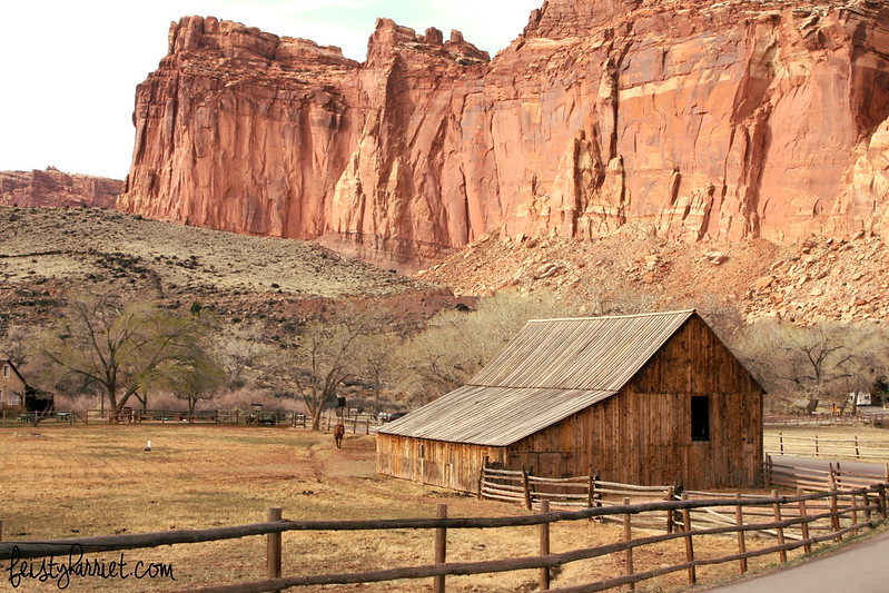
Great Basin National Park in eastern Nevada is full of ancient Bristlecone Pine trees, a couple of grueling hikes, and gazillions of stars. In late summer a friend and I packed up our camping things and drove across hundreds of miles of nothingness to reach the park; we had our sights set on the tippy top of Wheeler Peak, tallest mountain in Nevada at 13,065 feet.

Great Basin National Park, Nevada

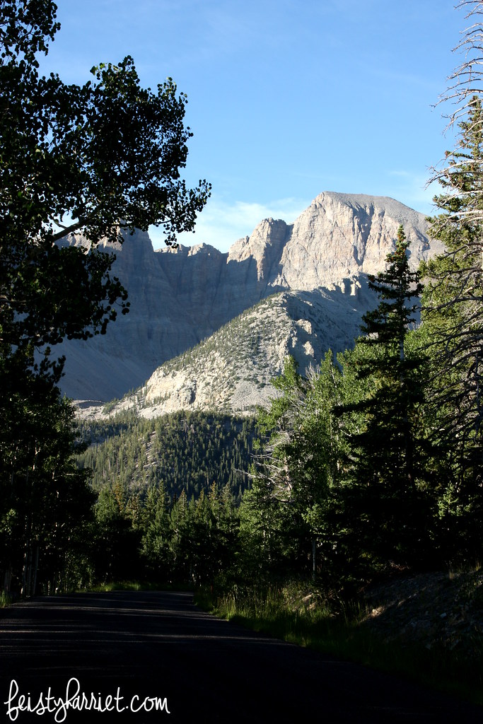
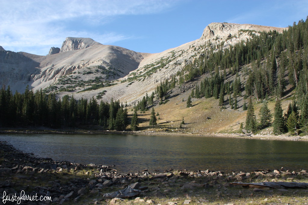
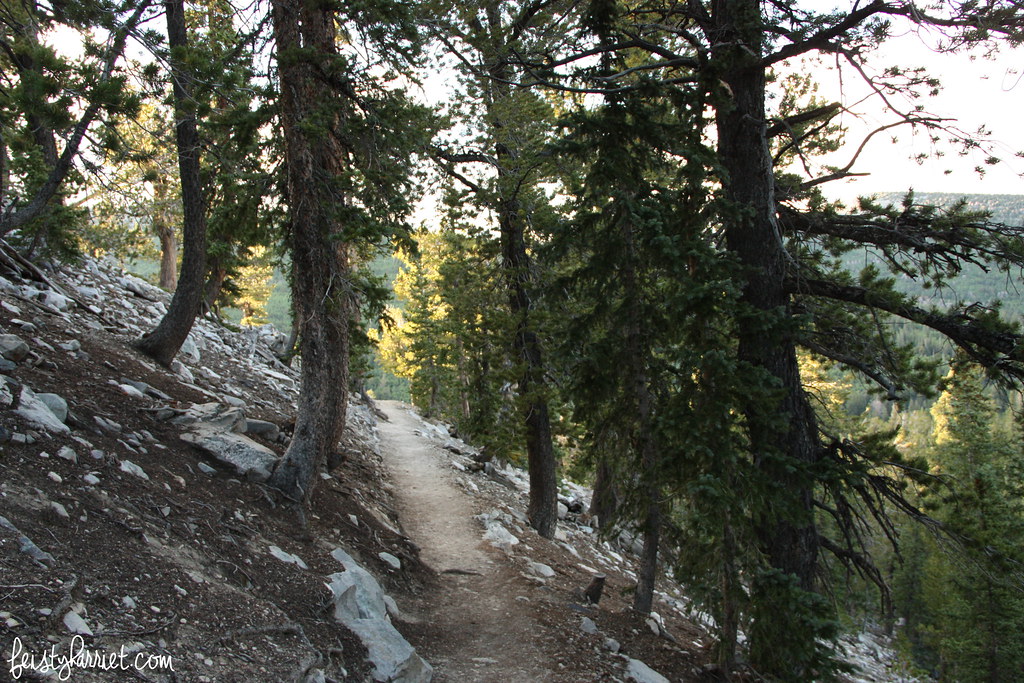
We woke up ridiculously early and were on the trail with that giant rocky peak towering above us. We hiked for a couple of hours on a relatively easy trail, nothing too steep, nothing too exposed, a little lake…

Great Basin National Park, Nevada

Then suddenly we were above the tree line, the trail was going nearly straight up the side of the mountain, the wind was ferocious and unforgiving.

Great Basin National Park, Nevada

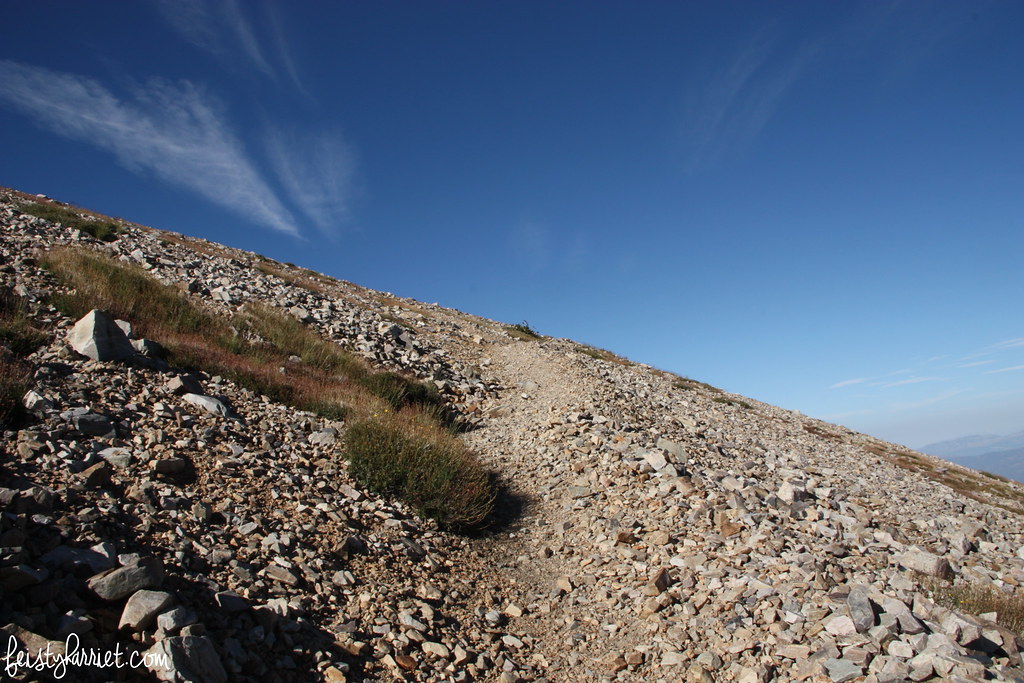
Honestly, the switchbacks were so narrow and tight you were essentially ladder-climbing and scrambling up a hunk of loose rock for nearly 2 miles. That picture up there shows the trail disappearing into the steepness of the mountain, but this was before it was super windy or super scrambly.

Great Basin National Park, Nevada

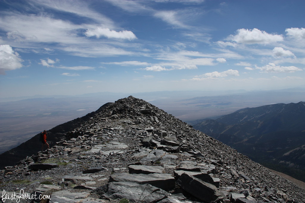
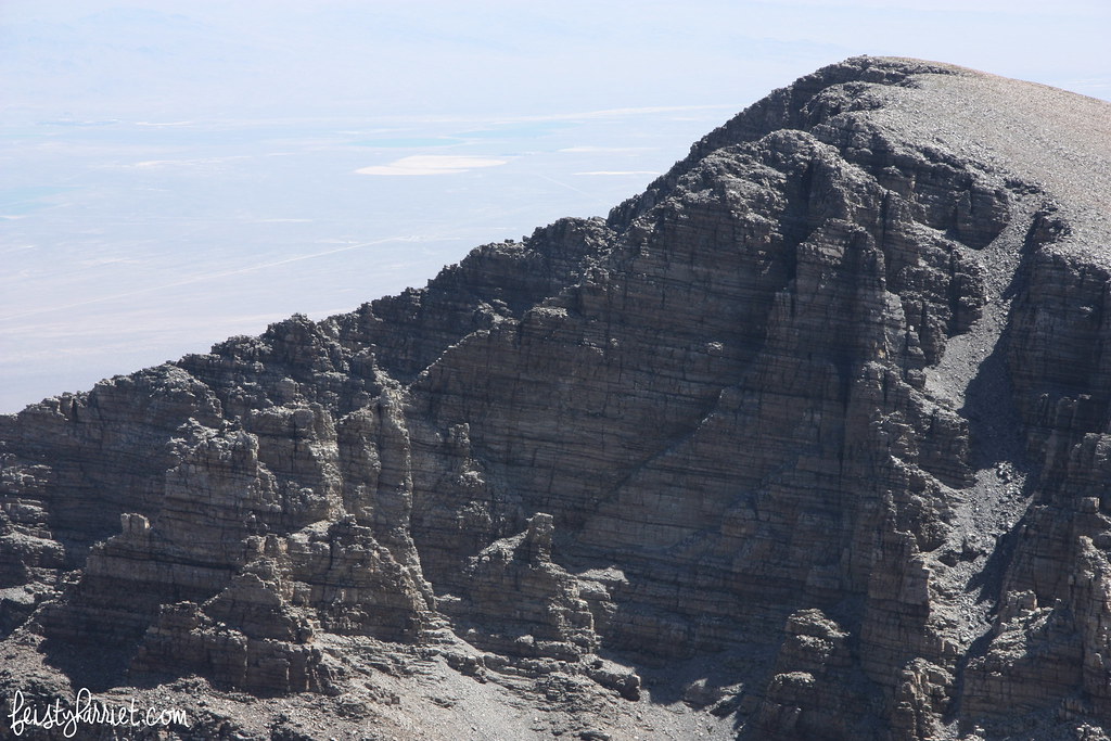
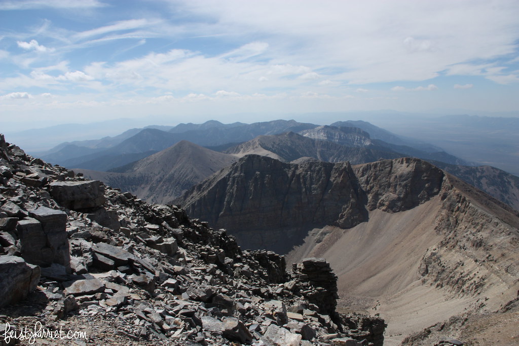
After a lot of stopping and wheezing in the thin air we reached the summit and were able to look out onto dozens of tall, rocky peaks, just like the one we were standing on.

Great Basin National Park, NevadaGreat Basin National Park, Nevada

A kind soul had built a little round fort-type thing up on the top out of loose rocks that gave some blessed shelter from the wind. We stopped for lunch, chatted with hikers as they reached the summit, and tried to psych ourselves up for the descent. It took us about 5.5 hours to reach the top, but we cruised down and were back at our car two hours later.

Great Basin National Park, Nevada

I had pretty low expectations for Great Basin National Park, but was completely bowled over by the brutal natural beauty and the incredible stars at night. GBNP has one of the darkest skies anywhere on earth, the number of stars we saw was completely outrageous, including the International Space Station crossing the sky, lots of shooting stars and meteors, and layers and layers and layers of pinprick constellations. The other thing Great Basin is famous for is groves of ancient Bristlecone Pine trees, some 5,000 years old! The thing about Bristlecones is they have no natural killer; the cause of death of most of these great trees is their roots are exposed and the tree eventually topples. What that means is the mountain they are growing on erodes faster than the tree dies…these trees are literally older than mountains!

Great Basin National Park, Nevada

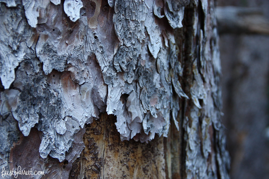
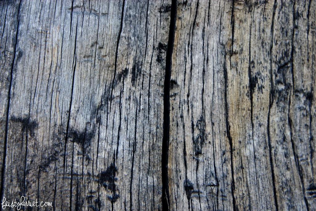
Their bark shows scars of hundreds and hundreds of years of rain and wind and snow. I probably could look at and pet tree bark all day long and not get bored, it’s just so fascinating. (Yes, I know my nerd is showing, just bear with me, okay?)

Great Basin National Park, Nevada

Great Basin is also famous for the Lehman Caves, vast underground caverns with all sorts of formations. However, the tours were completely sold out by the time we got there, so if you have plans to go, be sure to buy cave tickets in advance. And, if you are the photography type, take a tripod to get some shots of the night sky. And then send them to me so I can swoon all over again at the number of stars!

Harriet sig

Muir Woods, California

Muir Woods

Years ago I spent about 20 minutes wandering around Muir Woods National Monument, and it was approximately 37 hours not long enough. A whirlwind weekend in Northern California full of adventuring with my bff Bella and her family put us back inside this glorious grove of redwoods just north of San Francisco for the afternoon.

Muir Woods National Monument_feistyharriet_July 2015 (10)

We hiked the entire loop stopping every three feet to swoon at the enormous trees, the late afternoon light filtering through the leaves, and the lushness of this seemingly enchanted forest. Honestly, I would not have been one bit surprised if a wizard or a pack of fairies had emerged from behind one of those massive trunks.

Muir Woods National Monument_feistyharriet_July 2015 (9)

Forests like these simply do not exist in my part of the world. We have a few big pines, but nothing like this. The redwoods were so incredibly impressive; it is easy to see how people worship them. EASY! Some of my favorite trees had twisty, spiraling shapes in their bark, like the tree just kept twisting upwards and the stretch marks became permanent. Up, and up, and up!

Muir Woods National Monument_feistyharriet_July 2015 (16)

I wish I’d had my tripod or monopod with me, the low slanting light begged for long exposures to capture the golden glow throughout the trees, but many of my photos turned out blurry. Not to self: always bring your monopod!

Muir Woods National Monument_feistyharriet_July 2015 (14)

If you are in San Francisco Bay area I highly recommend getting yourself to Muir Woods. We waited for ages for a shuttle to take us there and again on the way back, and fought crowds the entire time. But even with all the teeming masses of humans I cannot imagine a better way to spend the afternoon. Unless, of course, you happen to have access to your own private grove of redwood trees…then do that.

Muir Woods National Monument_feistyharriet_July 2015 (5)

Harriet sig

Mt. Rushmore and Crazy Horse, South Dakota

Mt. Rushmore National Monument

Visiting Mt. Rushmore was one of the main reasons I wanted to go on this 2,000 mile road trip. Anti-climactic? Sure. Just a hunk of rock with faces in it? Sure. Freaking awesome? Absolutely. Sadly, I was foiled by tons of rain and lots and lots of fog. The rain was so heavy that my friend T and I simply stood there under umbrellas or the small overhang at the visitor’s center and stared at the fog for….probably 90 minutes total, waiting for it to clear just a little bit and more-or-less disappointed. I took a hundred pics with different camera settings and angles, hoping for some photo magic. Nope, no magic. My photo fairy godmother was busy or something because almost all of my pics turned out as a wash of gray-white fog with a few outlines of trees in the foreground. This was one of the “clearer” moments to see the mountain and her Presidential faces.

MidWestRoadTrip_Mt Rushmore_feistyharriet_June 2015 (3)

MidWestRoadTrip_Mt Rushmore_feistyharriet_June 2015 (1)

And this was as clear as it got. Kind of cool in a spooky mystical way? Yes. But I also desperately wish we’d had 3 minutes of no fog for a little more appreciation of the carvings. Next time, South Dakota. Next time. (Ditto on the Badlands which were closed due to flash flooding and washed out roads.)

Crazy Horse Memorial

The first thing you’ll notice is that there is actual SUNSHINE in these pictures…which lasted for about 45 minutes and I was glad we took the opportunity to see as much of this mountain carving as possible while the sun was out and the fog was at bay. Well…kind of glad. The 90 minutes we spent at Crazy Horse Memorial was the most frustrating part of the entire trip, rainstorms and picture-ruining clouds included.

MidWestRoadTrip_Crazy Horse Memorial_feistyharriet_June 2015 (5)

Chief Crazy Horse was a Lakota warrior most famous for defeating General Custer at the Battle of Little Bighorn (Custer’s Last Stand). In the 1940’s Lakota Chief Standing Bear approached one of the masons/sculptors of Mt. Rushmore and asked him to build a memorial to Crazy Horse and the Lakota people. This mountain is that memorial, although if we are being completely honest, it seemed to be more a memorial to Korczak Ziolkowski, mason/sculptor, and his family than a memorial to the Lakota. Korczak (Core-JACK) and his brood have lived near this hulk of granite for almost 70 years raising funds to complete their plans for a 600-foot tall sculpture, museum, and school for Native Americans. This all sounds lovely in practice, however the Ziolkowski (Zull-COW-ski) family refuses any sort of government funds–a fact that tell you about eleventy-million times–and the gowing is very very slow. The visitor’s center and “museum” are complete, but they are more a memorial to the Ziolkowski struggle than to the Lakota. Don’t get me wrong, there are a lot of Native American items in the museum, but the plaques simply state who donated the item and say NOTHING about the use or history of it. The marketing is all about the Ziolkowski’s and their determination to finish and fund this project, there is very little on Crazy Horse the man or the Lakota tribe, historically or currently. Outside of the actual carved mountain I found the whole thing very distasteful and rife with offensive political incorrectness. Honestly, there is a longer segment in the informational video about one of the Ziolkowski daughters who ran the gift shop (and an accompanying room in the “museum” dedicated to her life) than there is about Custer, Crazy Horse, the massive crimes the U.S. Government committed against the Native American people, or the current struggles or triumphs of the Great Plains tribes COMBINED. Wrongity-wrong-wrong.

MidWestRoadTrip_Crazy Horse Memorial_feistyharriet_June 2015 (6)

This is what the sculpture will eventually look like…you know, sometime in the next 300 years when they actually finish it. (And you’ll notice the fog returned with a vengeance. You’re supposed to be able to see the outline of the carved mountain behind this smaller scaled version so you can see progress and where things will end up and such. But, fog. More and more fog. And rain.)

MidWestRoadTrip_Crazy Horse Memorial_feistyharriet_June 2015 (4)

And this is what is complete so far after almost 70 years of work: Crazy Horse’s face and the top of his arm.

MidWestRoadTrip_Crazy Horse Memorial_feistyharriet_June 2015 (3)

Ok, I KNOW IT TAKES A WHILE TO CARVE A MOUNTAIN INTO A 600 FOOT TALL HORSE AND RIDER! I just feel like there is some gross mismanagement of funds on this particular project. “Keeping it in the family” has resulted in strange priorities, a lack of true business sense, and a skewed board of directors. Refusing any sort of governmental funding (which, I assume, also means grants from Arts foundations?) has slowed the process significantly and their marketing is abysmal and horrific. Honestly, their brochures look like a 7th grader made them in Microsoft Paint circa 1995. They tout education opportunities for Native American students, but I find it ironic that none of those opportunities include an internship in civil engineering, or drafting, or architectural blasting, or ANY of the activities that are required for completing this monument. Overall–in my opinion–a huge fail with a impressive partially-carved mountain behind it.

MidWestRoadTrip_Crazy Horse Memorial_feistyharriet_June 2015 (2)

Have you been to Crazy Horse Memorial? Did you spend the next 2 days of driving time ranting and raving with your equally offended and annoyed girlfriend about the misuse of funds and idolization of a sculptor instead of a learning opportunity about a great Lakota hero and the horrible things the U.S. Government and General Custer did to the tribes of the Great Plains? (Oh, that was just us? Hm, well, they don’t call me Feisty Harriet for nothin’.)

Harriet sig

Hovenweep National Monument, Colorado

Six months ago my sweetheart moved 700 miles away to the Valley of the Sun, we’ve each made a bunch of trips back and forth for weekend visits, but this particular weekend we decided to meet halfway and do a little exploring near the Four Corners area (Utah, Colorado, New Mexico, Arizona).

Hovenweep National Monument_feistyharriet_March2015 (2)

A few years ago we visited Mesa Verde National Park and explored it’s fabulous ruins of the ancient Ancestral Pueblans who lived there 700 years ago. Mesa Verde has a lot larger budget and considerably more well-preserved ruins, due both to protection inside the cliffs and a lot of excavation and archaeological studies. Hovenweep National Monument–Hovenweep means deserted valley–is from the same time period and the same people. Built almost a thousand years ago and abandoned by about 1,300 A.D., these sandstone block homes are incredibly impressive with multiple rooms and many with two or more stories, and windows and what I assume were thatched roofs. To date, no one can determine why exactly the Ancestral Pueblans left their communities in the Four Corners area (including the Mesa Verde peoples), but they do know that the traveled south-east and settled in central New Mexico.

Hovenweep National Monument_feistyharriet_March2015 (15)

Hovenweep National Monument_feistyharriet_March2015 (12)

From the visitor center there is a easy 2-mile loop that takes you along the rim of a small box canyon with clusters of homes along both rims and the bottom. The spring they used for water has long since dried up, but as many as 2,500 people lived here at once, the canyon echoing with the shouts of children and the noises of village life. These ancient peoples practiced dry farming on the mesa top surrounding their home growing squash and beans and corn.

Hovenweep National Monument_feistyharriet_March2015 (11)

Hovenweep National Monument_feistyharriet_March2015 (10)

Unlike Mesa Verde, you cannot get very close to the ruins, you cannot tour any of the homes or even walk inside them. However, it was fascinating to see the larger sandstone blocks held together with adobe and smaller stones filling the gaps; there were purposely square buildings, and round towers, and ingeniously built structures that used boulders as walls, building their homes nestled right next to a cliff or giant rock.

Hovenweep National Monument_feistyharriet_March2015 (7)

Hovenweep National Monument_feistyharriet_March2015 (9)

A few miles away from Hovenweep proper is a singular set of ruins called Cutthroat Castle with 5 or 6 structures in impeccable condition. Now, it’s quite a hike to get there from the main road, or a made-me-very-nervous 4WD only road (Blue Eyes is the driver for all such excursions that require 4WD and he wasn’t nervous at all, but I was). Cutthroat Castle was gorgeous, I loved that there wasn’t anyone else there, and I loved that we could get a lot closer to the ruins (we didn’t touch anything, just looked, and I took a million pictures, per usual).

Hovenweep National Monument_feistyharriet_March2015 (3)

Hovenweep National Monument_feistyharriet_March2015 (4)

If you go: there are bathrooms at Hovenweep, but no water for purchase and no other amenities. There is very little shade on the short trail and a lot of blazing sun, so bring a hat and sunscreen and plenty of water. If you have a camera lens with a serious zoom I’d recommend that as well. Hovenweep National Monument_feistyharriet_March2015 (1)

Harriet sig

Capitol Reef National Park: Fruit Orchards

I know many of you are still buried in winter, and I don’t mean to rub it in, but except for a day here and there we’ve been experiencing spring-like conditions since January. This is kind of good (yay! Spring!) and also really really scary (WHAT HAPPENED TO THE SNOW?!?!). I imagine our wildfire season will be worse than your snow season, so don’t throw stones at me quite yet.

That being said, last weekend while I was taking the very long way home from a weekend with my sweetheart, I kind of accidentally stumbled upon one of the most beautiful places I didn’t know existed; the fruit orchards of Capitol Reef National Park. Okay, I guess technically I did know they were there, but I did not realize how stunningly beautiful they would turn out to be. Mormon pioneers settled in Capitol Reef about 150 years ago, and they planted hundreds of fruit trees which in addition to a few houses and a school are all that remain.

Capitol Reef Fruit Orchard_feistyharriet_March 2015 (7)

The park rangers cultivate the trees and sell the fruit by the bushel or in overpriced fruit pies, and that is all fine and good, but in researching this park what I most wanted was to happen to be there when the orchards were in bloom. The image of rows of trees smothered in creamy pink blossoms sitting like a candied cloud at the base of towering red rock cliffs has been haunting my dreams for months.

Capitol Reef Fruit Orchard_feistyharriet_March 2015 (2)

When I found myself kind of in the area (meaning, if I drove 130 miles out of my way I would be “in the area”) I was immediately stunned by the gorgeous cliffs striped with red and orange, black and purple, creamy white and green. There are a few small stands of trees along the road through the park, I stopped at took pictures at all of them but was a little disappointed that most were just starting to bud and not yet in full bloom. I stopped at the Visitor Center to inquire if there were additional orchards, where they were, and if any of them were current in blossom.

Capitol Reef Fruit Orchard_feistyharriet_March 2015 (1)

The ranger gave me directions to the upper campground, located on Loop C, and told me a grove of 200 apricot trees were in full bloom a day or two before and he hadn’t been back since. I thanked him and headed that way, desperately hoping that there would still be a few petals on the trees.

Capitol Reef Fruit Orchard_feistyharriet_March 2015 (6)

I rounded a curve and was gobsmacked by rows and rows of trees just losing their white blossoms; I parked my car and as soon as I opened the door I could smell the sweet perfume from these trees and hear the bees. Kids were scampering through the orchard, a couple of people were having a picnic, some guy was taking a nap leaning against a trunk; it was magical.

Capitol Reef Fruit Orchard_feistyharriet_March 2015 (4)

I wish I had driven through the day before, many of the trees were gray-ish pink and has lost most of their white flowers, but I still walked through that orchard for almost two hours just reveling in the spring, the blossoms, the intoxicating aroma, and the red sandstone cliffs soaring overhead.

Capitol Reef Fruit Orchard_feistyharriet_March 2015 (3)

I need to go back to Capitol Reef, not only to explore a little more and do some hiking, but hopefully to spend a few nights in the campground adjacent to the apricot orchard. Honestly, this is the kind of place made of the stuff of dreams.

Harriet sig