Stormy Road

Grand Tetons_feistyharriet

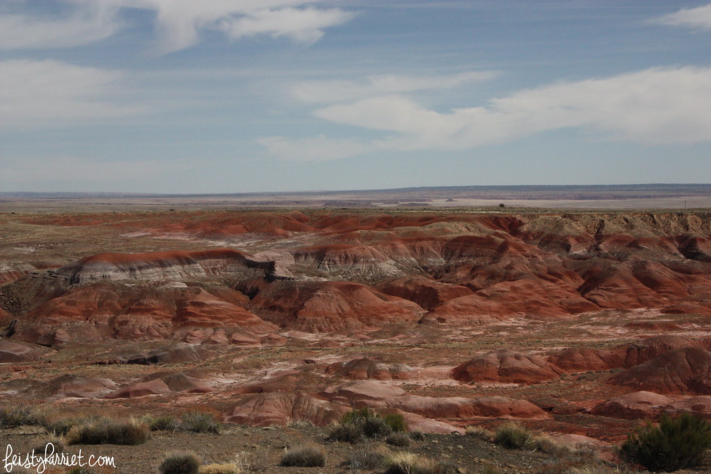
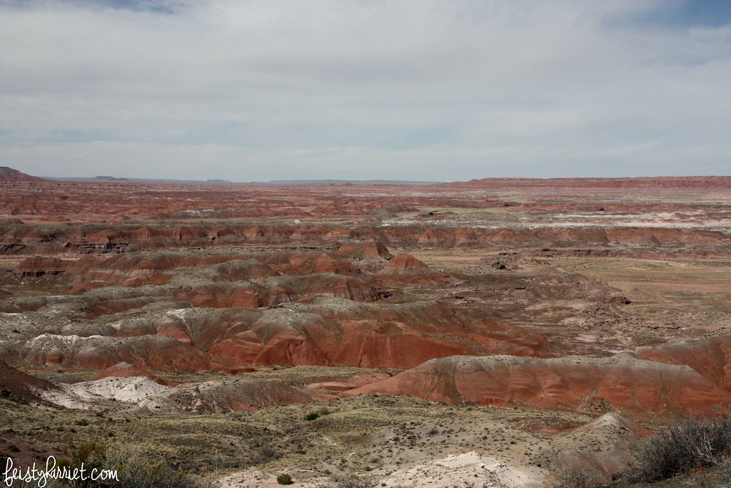
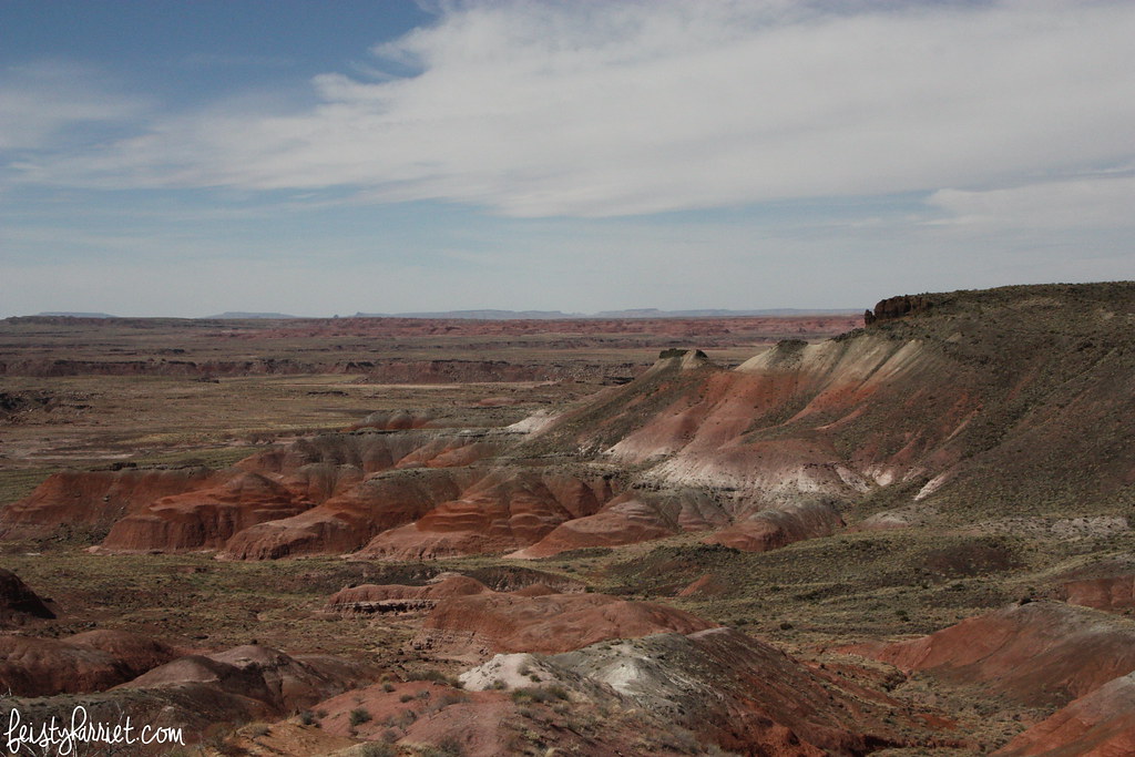
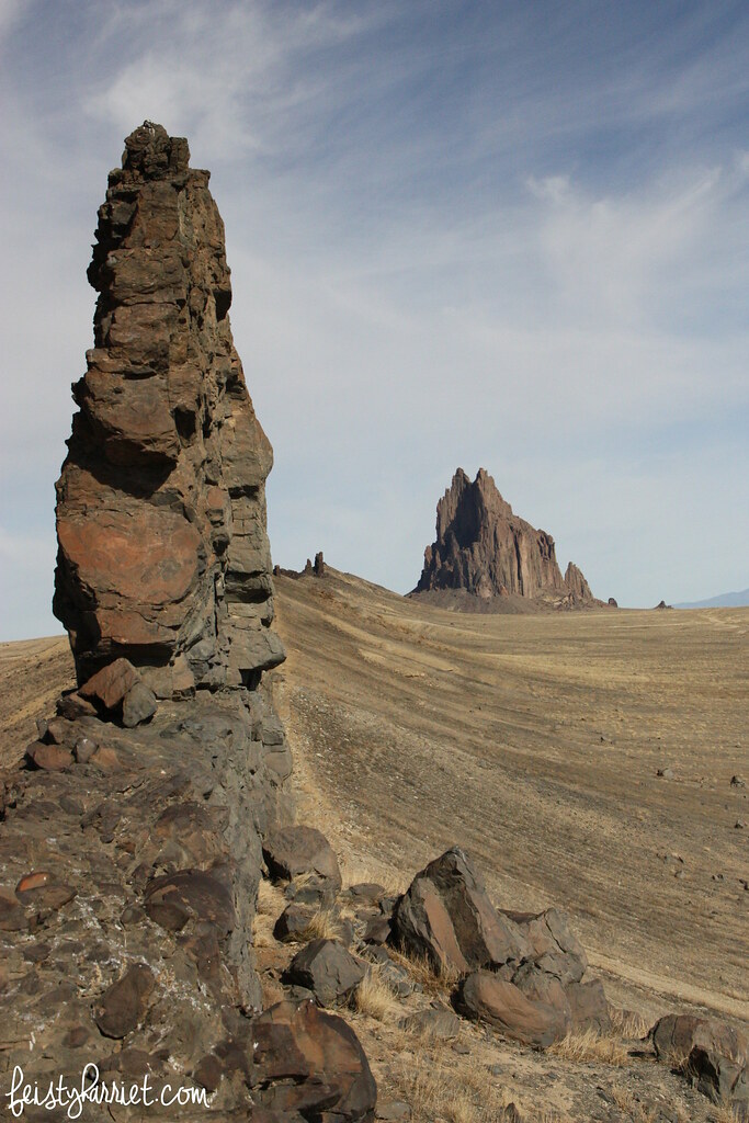
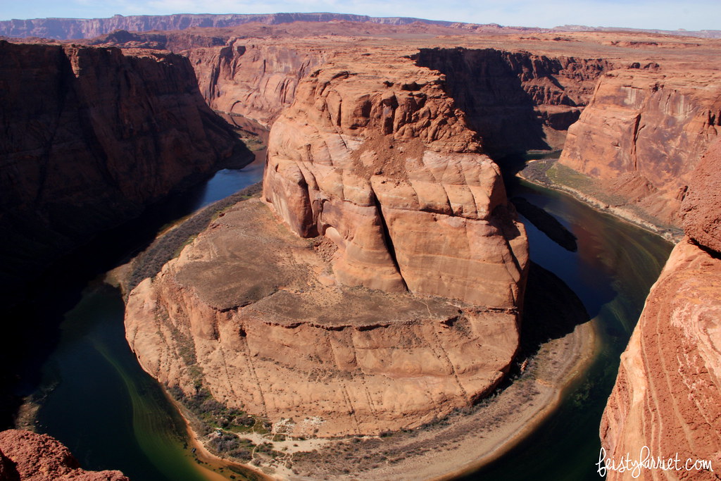
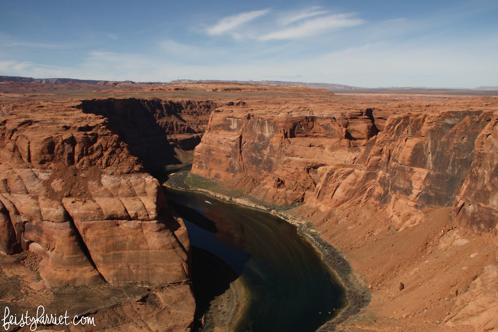
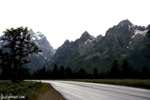
Once upon a time, in the middle of the afternoon, in the middle of summer, a tremendous storm rumbled over these mountains, shrouding the valley in darkness, temperatures dropped at least 20 degrees as the freezy rain and hail shot like tiny cannons from the sky. Blue Eyes and I were driving through Grand Teton National Park in Wyoming, enjoying the views and trying to decide what hike to do next. As the wet road turned into a slippery, steely ribbon I started to get nervous, we finally found a place to park and watch as the thundering clouds stormed east followed by a thick cape of streaming gray rain.

In less than 30 minutes the storm had passed–summer storms in the mountainous West are ferocious, but usually short lived. Thirty minutes. I can wait out anything for thirty minutes. Sometimes, you need to take each day thirty minutes at a time. Sometimes that’s all you can manage. And sometimes you’ve become so used to living thirty minutes at a time that you forget how to live bigger than that. I can’t stop thinking about my breakthrough in yesterday’s post. Live bigger. Live broader. Pick a destination and work towards it. My thoughts are still kind of jumbly on the specifics, but I already feel like the realization has brought me more clarity than I’ve had in a long time. I’m still in the middle of the storm but I’m finally off the slippery road that has been leading me to nowhere.

Harriet sig

Petrified Forest National Park

Once upon a time, in the middle of a very long drive from Salt Lake to Phoenix, I took myself on a little detour to Petrified Forest National Park in Arizona. It was a park I’d never visited, was literally right off my route (which was already a detour to include stops at Four Corners and Shiprock, NM), and I figured a quick stop to check it out would be a good way to stretch my legs. It was….well, it as nothing like I expected, and not in a very good way. I mean, the stripey desert was gorgeous, with layers of red and white and purple and green on the dunes and hills glowing in the late afternoon sun. It was too warm for me to really enjoy a little hike (when I’d left that morning it was in the low 30’s, the weather in Petrified Forest NP was in the 80’s with no shade and very few substantial clouds), and I had been subsisting off gas station snacks for a day and a half already.

Petrified Forest NP 1_feistyharriet_March 2016

So, instead of hiking down among the hills, I wandered around the look out places, and then drove to the next, and the next, and the next. Petrified Forest NP isn’t large, and there is a 20-ish mile loop that takes you through the most popular parts of the park. After an hour of driving and wandering and driving and wandering I still hadn’t seen any actual trees petrified into rocks, I’m not sure what I was expecting, but, I don’t know, maybe a few rocky stumps here or there?

Petrified Forest NP 2_feistyharriet_March 2016

Nope, just more striped hills. Pretty, stunning even, but for me this part was not As Advertised, and that usually leads to disappointment.

Petrified Forest NP 3_feistyharriet_March 2016

Towards the end of my drive through the park I pulled over to view Newspaper Rock, which is best seen with binoculars (or the zoom function of your best camera lens), humans aren’t allowed anywhere near the engravings, probably with good reason; time and time again humans in the general public have shown they are the worst for taking care of ancient spaces. That being said, I do wish I would have been able to get a closer look at these drawings, don’t they look so cool!?

Petrified Forest NP 4_feistyharriet_March 2016

As I headed out of the park the red striped hills gave way to gray and blue and green striped hills, they look a lot more like The Badlands in South Dakota than anything I’ve seen in Red Rock Country. And then, my camera battery died. I did see a few rocky stumps and sections of fallen trees before I exited the park, but most of my little adventure was striped and petrified desert. Again, that kind of geology is pretty cool, but it wasn’t what I was expecting.

Petrified Forest NP 5_feistyharriet_March 2016

The town of Holbrook, Arizona is just a few miles from Petrified Forest National Park (population: 5,000), they have petrified logs lined up like vehicles at a car lot, hundreds of them for sale, giant ones, medium-sized ones, smaller ones. So, if petrified logs is what you are hoping to see, you will probably have a better shot of seeing them in town than in the park–although it kills me a little to actually type those words out.

Have you been to the Petrified Forest? Have you ever been disappointed in a National Park? Do you pack extra camera batteries, prepared like a girl scout, to avoid lack-of-battery predicaments!?

Harriet sig

Tsé Bit'a'í, or, Shiprock, New Mexico

Shiprock Tsé Bitʼaʼí NM 1_feistyharriet_March 2016

I have made the drive from Salt Lake City to Phoenix and back more times than I can count. There are only a few ways you can go: the shortest distance, the shortest time, and the one with the least chance of bad weather in high mountain passes. On my drive back to Arizona a few weeks ago I decided I wanted to take a little different route because I really wanted to see the hardened and weathered insides of a volcano so ancient that it’s insides are now on the outside, the only remnants left of what was once an angry, molten-lava mountain.

Shiprock Tsé Bitʼaʼí NM 2_feistyharriet_March 2016

Called Tsé Bit’a’í by the Navajo, meaning “Rock with Wings” this formation is the giant bird that brought the Navajo safely to northwestern New Mexico. When white frontiersmen arrived they thought it looked like a clipper ship and renamed it (and everything else). Located on tribal lands and still held sacred by the Navajo you can walk around it, but you cannot climb it.

Shiprock Tsé Bitʼaʼí NM 3_feistyharriet_March 2016

Scientifically, this is the core of an ancient volcano with enormous fins of volcanic rock, up to 150 feet tall, radiating out in three directions. There are very few signs to lead you to the bumpy dirt road that will take you closer to the formation. Shiprock is quite literally in the middle of nowhere, the closest other landmark is Four Corners National Monument, which if you’ve ever visited is miles and miles from anything else. I did stop at Four Corners on my drive, it was a not-really-quick detour on my way to see this giant rock. Frankly, Tsé Bit’a’í is much more interesting without any tourist trap things to hijack your experience. Literally: no signs, no historical marker with the Navajo legend, nothing. There was one spray-painted sign half-propped up along main highway, but that was it.

Shiprock Tsé Bitʼaʼí NM 4_feistyharriet_March 2016

That big wall on the left is the most prominent fin stretching for several miles. I didn’t climb the wall itself (hello, respect), but I did walk up a little trail to the base to see what I could see. The drop off on the other side was considerably steeper than the slope on my side, I’m not afraid of heights, but it did make me gulp a bit. The scale of the wall is massive, I can only imagine what it would be like to stand at the base of Shiprock and try and see the top.

A note: I just found out there is a similar formation in north-eastern Arizona, the remains of an ancient volcano, complete with radiating walls of volcanic rock, about 1500 feet high. On my next trek through this part of the country I’ll probably have to stop and check it out too. I certainly have a thing for the leftovers of ancient volcanoes. Devil’s Tower in Wyoming is another example of an eroded volcanic plug, totally loved that as well.

Shiprock Tsé Bitʼaʼí NM 5_feistyharriet_March 2016

I am still completely haunted and mesmerized by this formation, I don’t entirely know why. As a white girl from Utah I have ZERO claim on it, not culturally, or geographically, or anything else. But I love it, all the same. I suppose, in some ways this rocky monolith reminds me of the rocky mountains that hold my secrets, the scariest and sweetest secrets that you whisper to the wind knowing she will take your words up to the highest peaks, and carefully hide them among the shadows and the deep places, safe from prying eyes and people digging around for answers. I honestly think part of my heart is formed from the peaks and caves and cirque’s of the highest, rocky mountains, part of me always feels safer with them soaring above me.

Harriet sig

Horseshoe Bend and Highway 89

Highway 89 2_feistyharriet_March 2016

For the first part of March I was lucky enough to be back in Salt Lake for some work-stuff, but also to spend some much needed time with my mountains, the city that holds my heart, and dear friends and family. The road to my northern home is approximately 700 miles long, and it’s primarily desert. But, the desert is, in ways both figurative and literal, my other home. I was driving by myself, which meant I could stop as often as I wanted to for pictures and little hikes. Frankly, I don’t know why I don’t do that EVERY time I make this drive!

Highway 89_feistyharriet_March 2016

There are several places in Utah and Arizona with these stripey hills and cliffs. Most are red, but the ones here are a greenish-gray with purple-y stripes and I have always loved them. They kind of look like enormous elephants taking a nap, and you know how much I like elephants. As you near Page on the Utah-Arizona border you wind your way to the top of the plateau that towers over Lake Powell and instead of looking up at the cliffs and formations you have the somewhat-stomach-dropping opportunity to (lay flat on your belly, inch towards the edge and) look down into the beginnings of the Grand Canyon at the famous Horseshoe Bend of the Colorado River.

Horseshoe Bend 2_feistyharriet_March 2016

I really wish that I had a lens to capture the enormity of this view, a major wide-angle or something so you can comprehend the vastness of the space, but also, comparatively how this tremendous bend doesn’t seem enormous when compared to the horizon and the knowledge that this is the northern end of the Grand Canyon plateau.

Horseshoe Bend 1_feistyharriet_March 2016

I mean, yes, it’s huge. Those are scrubby trees down there on the shore, not sage brush. But to think about how small this one particular place is on a river almost 1,500 miles long. This water started as snow in the Rocky Mountains of Colorado and winds it’s way through the deserts of Utah and Arizona, supplying power for Las Vegas and Southern California, before emptying into the Baja and on to the Pacific. And this is just one, tiny little bend of that river.

Horseshoe Bend 3_feistyharriet_March 2016

You can see a tiny smidge of white on the river, that is the wake of a pretty massive speed boat, the kind that could easily hold a party of water skiers without feeling crowded.

Goodness, this earth is gorgeous. I realize I’m biased, but I just cannot imagine how anywhere else can give you the thrill of redrock country. The cliffs, the scale, the colors, and the knowledge that a river of melted snow created hundreds and hundreds of miles of stuff like this. It’s the kind of thought that makes you feel incredibly small and unimportant, yet also determined to protect these spaces.

Harriet sig